10/25/2011

A "Grey" Day Hike

While I'd like to say the sun ALWAYS shines at Elk Lake, it doesn't. Sometimes it snows. Sometimes it rains. And, although a rare event, sometimes it is just 'grey'.

However, when a hike is in the works - well, I'm not one to stay inside just because the weather isn't on its best behavior. Since my hiking companions were of the same mind, we decided to make our hike - regardless of grey skies, threatened rain, soggy trails (from rain the night before), and gusty winds.

We loaded up the packs, the dogs, the lunch, the maps, the bear spray, the camera, the binoculars, the extra warm clothes - well, more than we needed but at least we had all the bases covered. The plan was to hike to Blair Lake - a hike I'd taken last year under very different skies!

We planned to take a similar route. Up the Corral Creek Trail to the juntion with Blair Lake. On up to Blair Lake. On the way back we thought we might take a sidetrip to Hellroaring Creek before finishing the day at the Hellroaring Creek Trailhead (which would require about a 1/2 mile hike to our vehicle parked at the Corral Creek Trailhead).

Well, things didn't go as planned. The higher we went, the lower the clouds. Between cold gusty winds and intermittent rain showers, we were looking forward to reaching our destination, finding a sheltered nook in which to eat our lunches and give our feet a break. However, when we reached the Blair Lake Junction, the mountain did not look inviting. The wind howled up those slopes. The clouds looked anything but friendly. Sheltered nook? Probably not up there. After a brief pow-wow, we decided the wisest choice would be to take the lower trail to Lillian Lake.

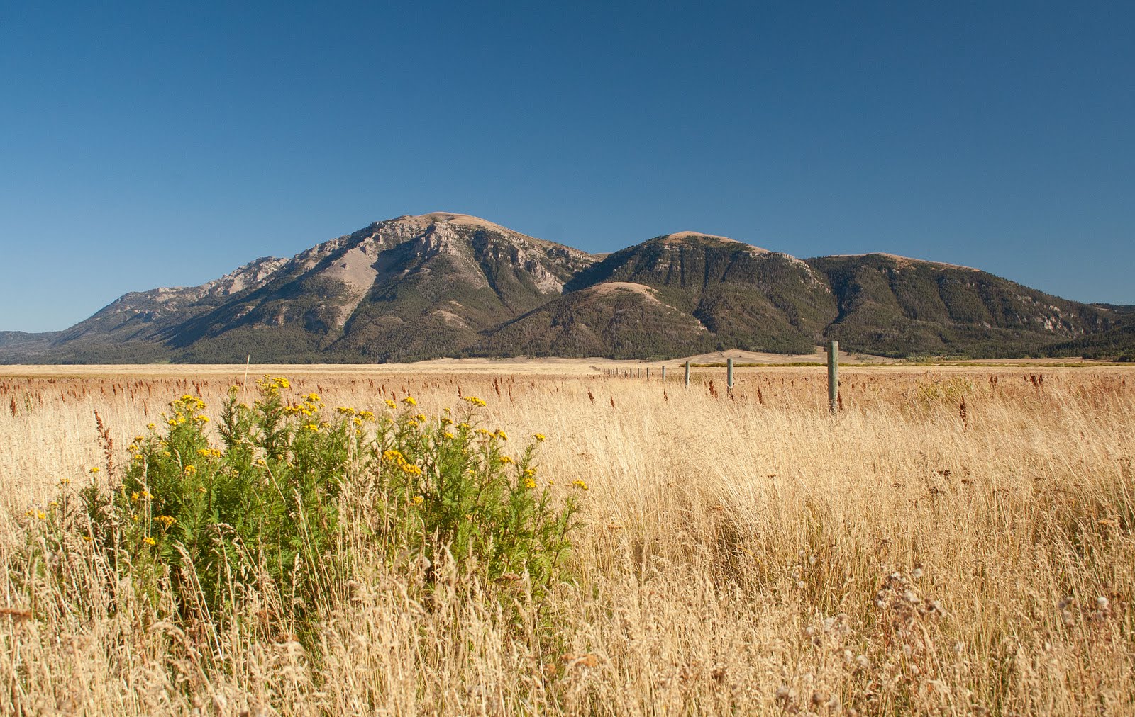
In spite of the weather and changed plans, beauty filled our day. While aspens are sparse up that high, the huckleberries and other low-growing bushes brought bright splashes of color to our storm-dulled day. However, what surprised us most were the wildflowers. While nothing to compare to the color profusion we enjoyed on our Sheep Lake Hike, I honestly did not expect to find one, let alone EIGHT different varieties, still blooming at this elevation. In October. After snow! Amazing!

Yet we saw: Common Harebells, Yarrow, Sulphur Buckwheat, Spurred Lupine, Alpine Asters, Indian Paintbrush, Englemann Asters, and Orange Agoseris! Who would have guessed? And these were blooming! While the remaining huckleberries had dried to grey globs, we found edilble Gooseberries, Thimbleberries, Black Elderberries, and Oregon Grapes! Quite impressive for early October at that elevation.

The clouds remained low so the splendid views this area offers were mostly hidden. Nonetheless, even with low clouds and occasional rain showers to obscure things, whenever the weather cleared, even briefly, we were treated to brilliant color in every direction!

It has been several years since I made the trek to Lillian Lake. In fact, I think the last time I was here was on horseback - four or five years ago?? I can not even locate a prior blog post on that excursion.

Lillian Lake, named after Lillian Hackett Hanson Culver, an early Centennial Valley settler, is a small lake tucked into a mountain basin. Blair Lake is larger. Blair Lake offers more spectacular views. BUT, Blair Lake is also near the top of the Continental Divide - up in those clouds and exposed to the gusting wind. Thus Lillian Lake was a perfect destination on this grey day.

Yet, after visiting on a windy day, I found my curiousity pricked. I am going to have to go back to Lillian Lake and do some exploring. That little lake appears to be tucked into a sheltered valley. However, the wind howling, gale-force, over its surface suggested it is less sheltered than I thought. Hmmmm!

Due to the changes in our route, we ended up making a near perfect loop. Up Corral Creek to junction into the Continental Divide Trail. Past the junction up (where, if you were following the Continental Divide Trail you would have to turn) to Blair Lake. Down to Lillian Lake. Across the upper reaches of Hellroaring Creek (I wonder how close we were to the headwaters of the Missouri?). North along the east side of the creek. Back across the creek and a bit west. A brief detour. Then down to the Hellroaring Trailhead and back to our rig.

The photo above, looking south-west from the east side of Hellroaring, shows the country up from which flow those famous headwaters.

I swear trailbuilders get their kicks out of imagining a hiker's frustration at finding a creek crossing without a bridge, a log, or any other 'dry' means of crossing. After all, it happens EVERY time. And so, on a cold, grey, rainy day, we had the privilege of taking off our shoes and socks, rolling up our pants, and wadding / stumbling across a slick-rock creek filled with snow-melt water. Talk about Chinese torture!

And THIS just proves my point. What did we find spanning the next 'trickle' (literally, we could have stepped across it!) merely a couple hundred yards from our frozen feet crossing? Yes - a lovely wide, wood bridge - followed by another just as nice crossing a nearby swampy area (which we could have navigated with dry feet as well!). What about COLD, SLICK, WIDE, and KNEE DEEP did they not understand about the *real* creek crossing? Oh well! I whine - and I didn't enjoy it - not that day - but it did add another element to our adventure.

Our trip would have been about a mile shorter had we chosen not to take our detour. However, Hellroaring Canyon is not a place to bypass - at least not when we were this close and one of the 'gang' had never been there.

So, when we reached this confusing trail junction, we took the trail to the right (the arrow pointing left in the photo). WARNING: Should you decide to take this hike, let's talk first. The maps (even the better ones) do not show the trails. In addition, there are two 'branches of the Continental Divide Trail (thus all the markers on these trees) - and one is only marked at the south end. This is not to say the area is hard to navigate. It is not. But going in with a bit of knowledge sure helps!

Hellroaring Canyon is a magnificent place. The creek really does roar through the canyon (and so does the wind in the winter!). Yet nature's harsher elements are softened by the canyon's beauty. Brilliantly and uniquely colored rocks. Abrupt canyon walls. Abounding color from willows and berries and other water loving deciduous trees and plants. White water flashes while clear still pools attempt to calm the wild stream. It truly is a magical spot. So, we stopped for a picture (note the bridge!) and a look around before heading back to the junction.

Note: it is possible, if one has two cars, to follow this trail to the Red Rock Pass trailhead. This section (see the trail on the right side of the stream) of the Continental Divide Trail takes one along the north face of Nemesis and across Cole Creek (which, I believe, flows from the big bowl one can see on Mt. Jefferson when heading east out of the valley) and finally to Red Rock Pass.

Our excursion came to an end just as the clouds began to break - at least where we were. We walked down to the Hellroaring Trailhead then along the two-track for about 1/2 a mile to the Corral Creek Trailhead and our vehicle. And, while we did not end up going where we 'thought' we would, no one complained. It had been a magical Centennial Valley day - even if the weather did dampen us, literally, it didn't mar our spirits.

Lady of the Lake

10/14/2011

Lower Red Rock Lake

Some days are diamonds - at least that is what the song says. And, while I don't often agree with the popular song' lyrics, I must say, the afternoon we spent on Lower Red Rock Lake had all the elements of a 'diamond day'. Cerulean - on the deep end - skies. Golden fields. Majestic mountain backdrops. Clear water. A comfortable breeze. A few surprises. Ahhh - what a day!

Lower Red Rock Lake, like its eastern cousin Upper Red Rock Lake, dominate Montana's Centennial Valley. Set aside as a wildlife refuge in the early 1930's, this area is one of the few remaining completely undeveloped locations of any size in the lower 48. While the refuge protects about 65,000 acres, conservation easements limit further development on almost all the surrounding private landholdings.

Both lakes provide superb waterfowl habitat. Both are shallow (probably never more than 10 to 12 feet in depth). Both are inaccesible, except during a limited time frame by non-motorized watercraft, year-round. Thus both are home to wildlife who rarely see their two-legged co-inhabitants. Of course this makes the experience that much better for those of us who prefer the less-developed side of life.

Since the youngest member of our party is still learning to row - well, to row with the ability to get from point A to point B - most of the family climbed into the canoe while I prepared to embark in my trusty kayak. Our destination? Well, that was a little up in the air. However, we knew we wanted to explore the lake a bit, and perhaps travel up one of the source streams.

One challenge faced by Red Rock Lakes' explorers is the weather. Perhaps you've read my 2009 post about our explorations of Upper Red Rock Lake. If so, you might recall the LONG PULL back across the lake to our launching point. The wind, while no where near its typical blustery self, added an unwanted degree of challenge to our day. Thus, as I looked across the placid surface of Lower Red Rock Lake which perfectly reflected Sheep Mountain to the east, I couldn't help but hope it stayed this calm.

The views were magnificent. From the Centennial Range to our south, to Jefferson to our east, to the Madisons to our north - there wasn't a bad view to be seen!

Much of the water which passed under our crafts that day looked more like a jungle than a lake. They say there are fish in these lakes - big fish. I know there are waterfowl - including diving ducks. However, while there were places we could see the lake bottom a few feet below our boat's bellies, much of the lake looked too thick to penetrate.

Our journey started on Lower Red Rock Lake's western shore. Since Upper Red Rock Lake sat to the east, we figured we'd have to head in that direction to find the connecting waterway. As we approached the eastern shoreline, I realized we were being watched by a local resident.

Two local residents, it turned out. I know moose are big. They are taller than elk and their long legs make them appear even taller than they are. In addition to long legs, a full-grown moose also boasts an admirable upper body! And, while I've always known they were big animals, when one is sitting at their feet in a kayak, they appear gargantuan. Thankfully these big boys were merely curious!

We figured the willows from whence the moose appeared just might prefer flowing water. Thus we now began to search in earnest for an inlet stream.

We had heard the waterway between Upper and Lower Red Rock Lakes was difficult to find. Well, our experience certainly doesn't contradict that. In fact, we cannot comment at all because we did not find the waterway between the two. However, we did locate the inlet to Odell Creek - by pure luck. Like any other swamp, everything is wet. Tucks and folds abound along the shoreline - each suggesting perhaps here a stream flows in.

So, as we scouted the shoreline, not really knowing what to expect, we watched for something more. More than ?? We weren't sure, but surely an inflowing stream would create at least a small current. And, low and behold, we found it (and it didn't look like the photo above. That was taken after the creek turned into a creek.)

Like our trip up Red Rock Creek in 2009, the trip up Odell Creek offered limited vistas. We could see the mountains in the distance. Occasionally we caught glimpses of the immediate vicinity. However, much of the time we were down in a 'ditch' of sorts, surrounded by high grasses, paddling across clear waters which reflected the sky and revealed several large fish but offered no insight into the world above its banks.

However, I am never content to see 'nothing'. In fact, I really cannot understand the person who steps out of doors - to hike or bike or row or just sit - and sees nothing. How can you settle into Creation's embrace and not see? To prove the point, I captured a few images of what I could see.

Colorful butterflies on the blooming thistles (which were magnificent on their own but whose magnificence I could not capture adequately on film). A sad little injured duck whose fate I chose not to imagine.

Two little birds (okay, I admit, I'm being lazy - I am not taking the time to identify them) chattering on the shore.

Even spider webs - amazing spider webs. I've never seen such profuse spider webs. I'm not sure if it is because so little traffic passes through this area. Or, maybe it was my perspective - below them - which brought them to life. Whatever the cause, I spent several moments enraptured by spider webs! Who would believe it?

Yet, always, Sheep Mountain dominated the scene. In fact, it was easy to track our progress by its slowly approaching bulk.

After rowing for about an hour and a half (approximately 45 minutes across the lake and another 45 minutes up the creek), we were ready to stretch our legs. While the shoreline offered few spots which invited one to disembark (the creek banks were fairly abrupt in most places), we did manage to find a stopping point. Wow! What a beautiful spot to take a break.

Looking north-west we could now see the country through which we had floated. Grassy fields stretched to the distant horizon. What a beautiful sight - and not a person or habitation to be seen. Amazing!

That look to the west reminded us time was quickly passing. We had at least 1 1/2 hours of rowing to return to our starting point - that was if the wind didn't pick up. So, we decided it was time to return to our faithful floating fleet. However, the fence a hundred yards to the east provided a beautiful prop for just one more photo of Sheep Mountain.

And, that's where this trip took an unexpected turn! The lush grass growing in these fields provided the perfect hiding place for my camera lens - the one which fell out of my pocket as I walked over to take just one more picture! While we spent precious time searching, it was to no avail. My, how it twisted my gut to climb back into my kayak without my zoom lens! (Therefore, it is with MANY thanks I report my wonderful husband repeated our trip the next day with a borrowed metal detector - found the unharmed lens and brought it home. Thank you, Lord. Thank you, Honey!)

Back in the water, everyone pitched in to paddle west. The weather was perfect. The views extraordinary. The company enjoyable. At this point I was a bit blue - kicking myself for losing my lens - but even that couldn't dampen the day's beauty.

The trip back down Odell Creek went quickly, almost effortlessly, as the current was heading our way. However, we still had to find (this part of the trip was the most interesting because it was the most challenging) the narrow channel which ran from the lake to the wide stream - weird but true. Once found, we backtracked around all those twists and turns, an easy feat for the kayak. A bit more challenging for the canoe's passengers!

Back across the lake we rowed against an intermittent but mild breeze. Since the Lower Lake is interspersed with numerous 'reed islands', the final challenge lay in locating our launching point. Thus I was extremely pleased when I realized I'd chosen an almost direct route, one which required little adjustment to deposit me on the shore near our truck. Here I enjoyed the views, the quiet, and the peaceful setting while I waited for the rest of the family to complete their trip.

Ah, what a day. I'd recommend it to anyone - but pick a windless day if you can! It really does make the whole experienced that much more enjoyable. And so ends just another one of the 'perks' of being,

Lady of the Lake

10/08/2011

A Trip Through Paradise (Part 3)

If you have been following my adventure, you have experienced the trip to camp (in Part 1) and an amazing (yet sometimes scary) trip around Sphynx Mountain in Part 2. Today we will finish this fantastic journey.

After the previous day's experience, I really expected the rest of the trip to be a piece of cake. After all, we merely had to load our gear and ride out - well, sort-of. My host and guide was not the kind to shirk his duty. He'd promised a full trip. He would live up to that promise. Thus the trip out would take us through more uncharted territory (at least for me). This translated into about 10 miles to travel before reaching our starting and stopping point.

Of course, like any other day, first things had to be taken care of first! So while we brushed our teeth, washed our faces, and combed our hair, Chance (and the rest of the crew) took the opportunity to scratch their backs and take on a good coating of mud (which, to their disgust, we did not allow them to wear).

After breakfast - ours and our mounts - we began the process of reloading our gear. It's funny how things 'change'. On the way in we'd had more to carry (because we'd eaten a lot of the food), but it seemed like we just couldn't get things to fit back into the packs as nicely as they had on the way in. I guess that is just par for the course. So, we put our heads together and managed to make it work.

An hour or so later, we had everyone loaded (even Chance who hadn't forgotten his role as the 'spooky kid' of the crew) and ready to go. After another walk through camp to be sure we'd returned everything to its 'natural' state, we were ready to mount up for the ride home.

Today's route would backtrack about 2 1/2 miles of yesterday's trail before turning east. Back up along McAtee Creek past the junction with Cougar Creek we traveled in a northerly direction. Sphynx remained on our left but was hidden from view. About three miles into our ride we came to a pretty little meadow which offered unobstructed view of the McAtee Basin.

Soon the trail turned east and we began the climb up to Inspiration Ridge.

There are times in life when valor stems from complete ignorance. Today was such a day. While Gale had regaled us with stories of other people he'd taken along the route we were to travel this day, I assumed (and most likely correctly) he was sharing the most interesting stories. Thus to hear him speak of riders who had stopped speaking until long after they had descended the other end of the ridge we were ascending - well, I figured they were greenhorns. Since I was not unaccustomed to mountain trails - and since I had survived yesterday's experience without losing my tongue, today should be a piece-of-cake! Certainly the beginning of what I call "Inspiration Ridge" (the trail is known as the Inspiration Trail) looked harmless enough.

The first part was pretty tame. However, what looked like a mild, partially tree-covered ridge, soon showed its real face.

You've heard it said, "A picture is worth a thousand words." Well, when the picture loses its ability to communicate reality, you know you're experiencing something quite unique. I'm proud to report I did not lose my ability to speak. However, that is not to say I didn't start to chatter - I may have done so. I honestly can not remember. What I do remember was doing anything to keep my mind off of where my horse (remember BORROWED HORSE) was putting his feet!

As our trail turned southeast along Inspiration Ridge, I picked up this view to the north. That chaulk-colored hillside circles around the headwaters of Buck Creek.

If any of the following photos look blurry, they probably are. Taking photos in low light (it remained overcast the remainder of our ride) off the back of a moving horse (only a CRAZY person would have attempted to stop their horse along many sections of this trail because a stopped horse does not necessarily mean a non-moving horse) does not tend to produce crisp, clear photos. And, there is always the possibility (a likely one) my hand was shaking too!

To my right (south-west - mostly west) Sphynx once again dominated the skyline.

In all the interesting stories my guide had shared with me on our way to the ridge, there were two pieces of information he excluded (or my brain just blanked out). One - the length of time we would spend on this hog-back. Two - the narrow aspects of this particular 'trail'. Thus as things became more interesting, I ignorantly comforted myself with the thought, "This can't last much longer." WRONG!

To keep my mind off my horse's feet which were passing within inches of thin air on my left, I tried to enjoy the view. This is the Buck Creek drainage - a drainage we paralleled throughout this segment of our journey.

To the south-west we had a view down toward our campsight of the previous two evenings. While I cannot name with confidence the drainages upon which I gazed, according to the map this must have been the upper regions of McAtee Creek or perhaps the Gorge Creek drainage.

Have you noticed my horse's ears, clearly seen in most of the 'trail' photos? Always looking alertly ahead. This gave me a measure of confidence as the trail, instead of improving as I'd naively hoped, continued to get a little scarier and a little hairier!

To my right - more and more over my right shoulder - Sphynx continued to watch over our progress. Looking back upon its cloud-shrouded form, I couldn't help but remember yesterday's trail. While I still remembered vividly those narrow, rolling rock avalanche shoots my horse had calmly traversed, I now realized that trip was merely a warm-up for the real fun. After half-an-hour, I was really hoping the end of this narrow hog's back was just up ahead.

It wasn't! In retrospect I am thankful I did not know we would traverse this knife ridge about an hour. At one point, since I doubted I would ever hike this section of trail (and I'm not sure I have the nerve to ride it again, now that I know what I'd be riding into), I snapped several quick pictures looking straight down. I didn't dare look for fear the vertigo would pull me into the abysss. However, this one, while a poor medium to convey the feeling of the earth dropping away beneath your feet, at least shows where I might have been had my horse mis-stepped more than a milimeter.

And still the trail continued. On and on we traveled down the narrowest ridge I had ever traveled - on horseback or foot. To the right the slope slid down and away at a dizzying speed. To the left there wasn't anything left to slide away. It was gone! One step too far in that direction and my horse and I would have fallen straight down at least 1000 feet!

However, there are times when it is just not wise to think about what 'could' happen. After all, if I let my imagination go, I know, even many months after the experience, I could NOT have stayed on my horse's back. So, to keep my imagination in check, I tried to enjoy the view. Still looking south-east (mostly south), I continued to behold beautiful views into the Buck Creek drainage.

When I mustered the nerve to twist around in my saddle to the right, Sphynx continued to dominate the skyline to the northwest.

If you're starting to wonder if I'll ever get off this hog's back, you're beginning to feel like I felt. After all, one can only enjoy so much excitement - and I had just about had my fill for the day! Yet it went on and on and on and . . .(you get the picture - and, believe it or not, I didn't take many pictures along this stretch of trail).

One last view of Sphynx for the trip - now a more distant highpoint on the horizon - and our trail turned from south-east to south to a little south-west.

Around the bend, and without any warning, I found what I had been looking for during the last hour - a wide spot in the trail! While we were technically still on the ridge, it was no longer a knife ridge sticking its blade into the sky. Things had mellowed (and leveled) out and I was more than ready to stretch a few fear-cramped muscles. Apparently I was not the only one for, a few minutes down the trail, our guide called for a lunch break.

I don't know if stock get nervous traversing narrow trails. Perhaps they do but hide it well. Perhaps they do not because their imaginations are less active than those of their riders. Or, perhaps it was just that my borrowed horse had traveled this trail before - more than once. Perhaps a 1000 foot drop inches from his feet no longer caused his muscles to bunch.

Regardles of the reason, as we remounted after our lunch break, I was singing my mount's praises. He'd taken me safely through the hairest 'adventure' I'd ever experienced on horseback. As our trail took the short drop down to Lizard Lakes, I realized even with such a steady mount, this story could have ended a LOT different IF, somewhere along that knife ridge, we had met up with the Grizzly whose tracks we had followed just a day earlier.

What does a horse do when it meets a bear in the trail? Even as I relaxed knowing I would probably never know, we passed alongside the smallest Lizard Lake (two little lakes - the one along whose shore we passed was little more than a tarn) and headed down the meadow to the south. About the time I heard the claws on bark, the mule I was leading suddenly rushed past Chief - and that with Chief doing his best to bolt forward. As I grabbed for my horse's reins and the mule's lead, I was looking for the bear. (The brain is an amazing thing. Although, to this point I had never met a bear in the woods, I knew what I had heard and what my animals had heard and smelled.)

Sure enough, to my left, a sow was anxiously pacing back and forth. Now, keep in mind, this is all happening at mach speed. Yet, even as my mind whirled and my hands and body sought to control and calm my mounts, I was grabbing for my camera. I HAD to get a photograph of this bear.

If this picture looks at all clear, it is completely due to a good photoshop program. Nothing (including my hands) was in a state of non-motion. Yet, I did manage to catch about three shots of this agitated mother bear - but her genus I will not attempt to designate with certainty. It all happened TOO FAST and my photos are just not clear enough. But, a bear is a bear is a bear - and I could not help but thank God we did not make her acquaintance up there on that hog's back!

The rest of the trip (outside of a well-behaved, completely trustworthy horse who had carried me safely over the worst trail I'd ever traversed suddenly became VERY antsy as we approached the trailhead) was mild in comparison to everything else we had experienced. While the map is a bit deceptive, we took the right fork (heading a bit south-west when the main trail turned east) and cut across an alternately open and timbered hillside to junction with the trail we had traversed two days earlier.

About three-quarters of a mile further we reached our destination - seen here from the top of the ridge before we began our decent. I imagine everyone (people and animals included) was happy to call it a day. We were all ready for a more 'civilized' and 'safe' environment. However, I will never forget the memories made, the experiences shared, or the companionship enjoyed on this trip. I have seen paradise - and at times I felt like I'd surely been to hell and back - and yet I survived it all (and enjoyed most of it).

Would I do it again? Probably. I do not think one should let such unique opportunities pass them by. And yet, I might ask to be blindfolded for portions of the trip (but most likely not!).

Lady of the Lake

If this story has stirred your sense of adventure, the maps below chronicle our trip.

Day One we traversed the trails marked in orange - from the 'Trailhead' to 'Camp'.

Day Two we traveled the green loop. We started at 'Camp', took our longest break at 'Lunch Break', and returned, by day's end to 'Camp'.

Day three we covered the trails marked in pink. We started at 'Camp', headed north-east, then turned east, south east and finally south to end up at the 'Trailhead'. (Note: The map for day three incorporates the south half and the north half of the Lee Metcalf Wilderness map. Unfortunately the maps are not presented in the same scale. Thus, where the maps join, they do not match perfectly.)